Thursday, April 14, 2011

07-11.04.11 Trujillo & Huanchaco

After 3 weeks of trekking, in the rain, we thought it was time for a bit of sun. Not only that, the thought of being back at sea level with humane levels of oxygen to saturate our thirsty lungs seemed seemed like a good idea. Trujillo just happens to be on our route to Ecuador so seemed like a sensible place to stop. The city was traditionally a trading post for coastal and jungle goods and is also home to the ancient city of Chan Chan, a major city of Chimu origin and later Inca rule when the Spanish arrived in the 1500's. After continuing to be a centre of rebellion, including numberous wars seeing the Conchuro Indian warriors, allied with the Incas, killing many Spanish conquisadores, Trujillo declared it's independence from Spain in 1820, making it one of  the first latin american cities to do so. Good for them I say.

The beautiful pedestrianized street of Jiron Pizzaro lined with Rococco style colonial mansions


Once again we were greeted at the bus terminal by an uninvited and overeager taxi driver posing as a bus official. It seems to be the norm. Undeterred we jumped in his cab and headed to Huanchaco, a small sea fishing village turned surf bum hang out 10km from the city. Without a reservation he drove us to a hotel of his choice which happended to be cheap. It turns out that these guys get commision from the hotels for hand delivering dumfounded gringos.

Trujillo Catedral in the Plaza Mayor


For our first day we planned to do absolutely nothing. After so much trekking we thought we would enjoy it. In short, we soon got bored. The highlight was a seafood lunch of ceviche, a classic Peruvian seafood dish, eaten by locals for over 2000 years. It consists of raw seafood marinated in lime juice and chilli. We went for the corvina (sea bass) and cangrejo (crab). It was fantastic but eating the raw crab took some figuring out.

We booked a guide to see the the ancient ruined city of Chan Chan and the Huaca del Sol and Huaca de la Luna (Sun and Moon temple). Chan Chan was the capital city of the Chimu Empire, an urban civilization which appeared on the coast of Peru around 1100 AD before being later incorporated into the Inca Empire. Totally unlike any of the Inca stuff we have visited Chan Chan is made of adobe bricks, basically mud which has been shaped and left to dry in the sun. In our opinion, the sun and moon temple were far more interesting. Set in a totally baron desert landscape the Huaca del Sol is by far the largest adobe structure in the Americas. It's basically a gigantic mud pyramid which is yet to be fully explored or excavated. Just 500 metres away is it's twin, the Huaca de la Luna. This temple is smaller but far more complex with incredibly well preserved coloured frescoes. The Peruvians think this was the most important ceremonial centre for the Moche culture between 400 and 600 AD. The perfect preservation is due to a bizarre process which the Moche's carried out of burying the temple before the 100 year el-nino and rebuilding another, slightly smaller temple, on top once the storm had passed, thus creating an adobe pyramid. It was quite spectacular and left us completely dumfounded. Again...

The Huaca de la Luna (Moon Temple). The frescoes were buried for 1500 years


 Detail of the decapitated head fresco with original paint


The Huaca del Sol, an as yet unexcavated and unexplored pyramid.


The external facade of the Huaca de la Luna. 100 years separate each level. 
Each one was buried to protect it from a devastating el-nino


The bizarre waffle like abode mud remains of the vast city of Chan Chan


Whilst we were in Trujillo it was the Peruvian presidential elections. Now, unknown to us beforehand, in Peru it is illegal to sell or drink alcohol 2 days before and 24 hours after the elections which took place of Sunday 10 April. The government say this is to ensure peope are thinking properly when they vote. We went out for a bite to eat and the place was like a ghost town with the odd gringo walking around scratching his head. We ordered a drink in a restaurant only to be told the law. On a plus note, we had 3 days of not drinking. Not by choice I might add.

Handmade tortura reed boats on the beach at the fishing village come seaside resort of Huanchaco


Next stop Ecuador...


Sunday, April 10, 2011

31.03.11 – 06.04.11 Huaraz and Cordillera Blanca


The town of Huaraz is sandwiched between the Cordillera Blanca and the Cordillera Negra mountain ranges approx 300km north west of Lima.  Although the town itself has little of offer, the mountains were the main draw.  The Cordillera Blanca is the highest tropical mountain range in the world with over 35 peaks above 6000m including Peru's highest peak, Huascaran at 6768m.

Peru's highest peak, Huascaran at 6768m.


Our arrival was (again) greeted by the rain so we accepted the offer of a taxi to our hostel by a friendly Peruvian named Max.  His first attempt to get us in an unmarked taxi failed and we thanked Max for his time as we jumped into the nearest official taxi.  We were pretty confused when Max jumped in the front of our taxi and assisted us to our hostel.  We quickly clocked that he was a tout when he tried to persuade us to view another hostel of his choice.  Strangely though he wasn’t deterred when we firmly advised that we had a reservation and he accompanied us into our hostel.  He got the message that we were tired after a long bus journey and he gave us his details to discuss our trekking options the following day.  It seemed that Max had his fingers in many pies.  After discussing our options the following day with Max and a couple of other tour agents, we settled on a recommendation with Galaxia Expeditions for the 4 day, 3 night trek from Langanuco to Santa Cruz valley.

After a 6am pick-up and breakfast at a local town Yungay, we made our way to the start of the trek in Vaqueria.  Unfortunatley, about 10 mins into the journey, the van broke down - suprisingly this was the first time a vehicle had broken down on us in South America.  We were lucky to have blue skies and a fantastic view of the mountain range, although this didn’t make the next 2 hours pass any quicker. 


Once the replacement van picked us up, the guides were keen to get to make up time and after a brief stop at the Langanuco Lakes we snaked up the winding valley to the 5100m road pass.  We were a bit disappointed that the van didn’t stop to allow us chance to take in the views but we understood that we needed to get to the first camp before it got dark.

Langanuco Lakes


Our group was larger than we expected and included 4 South Koreans, 2 Germans and 2 Dutch.  We didn’t bond as quickly as the Inca Trail bunch but they were a friendly bunch all the same.  We seemed to wait at Vaqueria for an age whilst the van was unloaded and all the kit was split into packs for the donkey’s by the donkey driver.  Shame there was no donkey’s to be seen!

Village of Vanqueria and a posing donkey - not one of ours I may add!


We set off on the trail leaving the donkey driver waiting for the donkeys.  The guide Eric took the decision to stop at a different campsite at 3750m due to the pending night fall and off we set on the trail.  After a lot of stopping and starting after every minor hill, Ryan and I rolled our eyes to each other wondering what we had let ourselves in for.  Turned out that there was no shelter at our ‘wild’ camp and the guide was conscious that the donkeys with all our equipment hadn’t passed us yet. 

That night I had a terrible sleep, waking up several times shaking in my sleeping bag.  This caused me some concern as I was wearing lots of clothes and was sweating hot.   My heart was beating very fast and I was fearing the worst for our toughest day.  I don’t think my mentality helped the situation but I had the worst day hiking ever.  The walk itself was really pleasant with a relatively gentle path rising up 1000m through the valley.  Our group split into two early on with 3 of the Koreans taking a much slower pace than the rest of us with Jihyun the other Korean, Ryan and I were at the back of the first group.  The altitude really affected me and I had to walk so slowly to prevent my heart rate going through the roof.  My lungs were burning and it felt like I was unable to take in a full breath.  I have to say I hated it and to top it all off it threw it down with rain.  After a few fake smiles at the 4750m pass and some random flute playing from our guide, we flew down the other side of the pass to our second nights camp at 4250m.

Fake smiles all round...


We woke up on day three to clear (ish) skies and were rewarded with some fantastic views of the surrounding snowy peaks.


Me packing the tent up on my lonesome whilst Ryan took the piccies...


The third day was a pretty easy day, spending approx 7 hours walking down through the Santa Cruz Valley.  We were supposed to walk to a view point near the Alpamayo Mountain but our useless guide took us half way there and tried to pretend we had walked all the way.  It didn’t take away from the fantastic views we had down the valley and off the snow capped mountains beyond. 

View down the Santa Cruz Valley


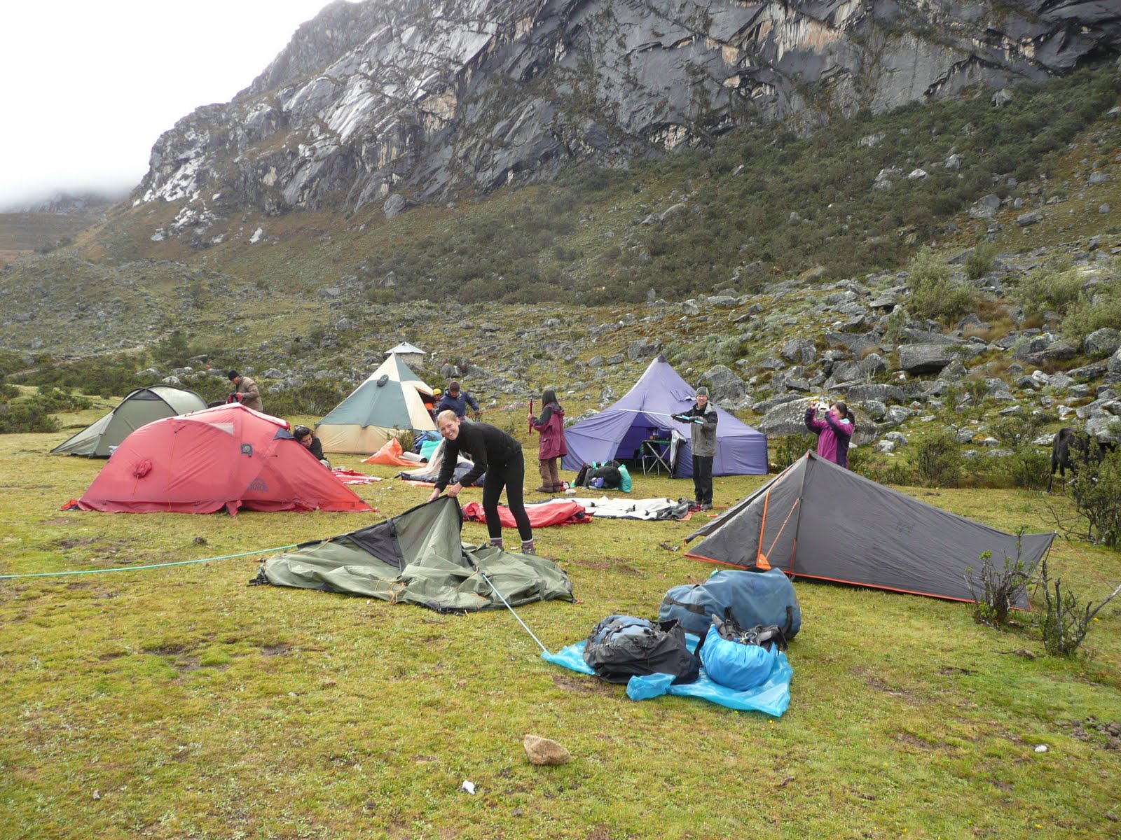
The final night's camp was a pretty interesting location.  The site was one the side of a rocky hill flanked on one side by a very fast flowing river and another side by stream.  Our guests for the night were our 6 donkeys, a cow and a calf - all of them leaving us nice presents outside of our tents for the next morning.  Our final day walking was just 1.5hrs down to the village of Cashapampa just in time for a group photo and to catch our bus back to Huaraz.

Group photo in Cashapampa having just finished the trek

The trip had quite a few up and down's although overall we enjoyed the experience.  Neither of us had been wild camping for more than just one night and we found the lack of porcelain quite challenging at times.  Although given that we have been travelling now for over five months, the lack of washing facilities didn't seem to bother us! 

Tuesday, April 5, 2011

25 - 29.03.11 - The Inca Trail to Machu Picchu

The world famous Inca Trail to Machu Picchu was always going to be one of the highlights of our trip. We had been advised that bookings are required at least 6 months in advance due to an imposed limit of 500 people on the trail each day. In practice we booked our trip only 10 days earlier with Llama Path, a reputable trekking company, only to find we were in a group of just 7 people.  Perfect.  Having wolfed down a ridiculously hot pizza, a beer and a glass of wine in less than 10 minutes, Rach and I were still late for our 7.30pm briefing the evening before the trek.  At the briefing we were introduced to our group.  Ryan and Cynthia from Canada, Irish Dave and Scottish Debbie from Dublin and Drew from Northern California. Any reservations we might have had of getting lumbered with a bunch of imbeciles were soon quashed over a round of coca tea with a good level of banter.  In came our guide Flavio to give us the run down over the next few days starting with the inevitable 4.30am start the following morning.  Ouch!

Day 1
We arrived at the meeting point jaded but on time. As we clambered onto the bus half asleep we were greeted with a full round of applause by the Llama Path porters. We were amazed to see 13 of them (12 porters and 1 cook), more than a football team, all dressed in bright red Llama Path livery. It all seemed a bit ridiculous really but we were assured that 2 porters per trekker was the norm. These guys carry everything from tents, cooking facilities, food for 4 days, table’s chairs, the lot. We set off towards Ollantaytambo in the Sacred Valley where we had breakfast before a 40 minute drive up a dirt road to Chilca, the start of the trek.

After a quick group photo we set off over the Urubamba River for a 5 hour trek to our first nights camp site at Huayllabamba. Enroute, we stopped a couple of times for a break. The first being after the first real climb of the day where a local lady was selling Chicha, a traditional corn beer made on the mountain. We all had a taste to varying levels of enjoyment.  Personally I thought it was quite good and could have managed a few pints. Dave managed to break the last of the proverbial ice by pointing out the 5 legged donkey making a bee line for Rachel. It was a hilarious moment and the catalyst for some classic comedy quotes, mainly by Dave, over the next few days. Just don't mention the quality of Andean music!

From left to right - Dave, Debbie, Ryan, Rach, Drew, Cynthia, Ryan


Lunch was in a shed at a small settlement half way up the pass. It was at this point the heavens started to open. Well it is the rainy season after all. To our amazement, the porters (we referred to them as the red army) had raced ahead, each carrying up to 25kg's each, to prepare a 3 course meal. It was top quality and much better than the backpacker food Rach and I have become accustomed to. After another 3 hours or so we reached our camp. The porters had arrived before us and had already put up our tents.  The cook Cecilio was already busy preparing our dinner, another fine feast. How this guy was preparing meals, on a mountain, in the rain, with minimal cooking equipment, was nothing short of voodoo. We went to bed at 8pm ready for a 5.30am start. It rained most of the night but we were warm, dry and dead to the world.

Being overtaken by the Red Army as they rush to set up camp before we arrive. Hats off!


Day 2
The following morning was the toughest part of the trail. A three hour climb up Dead Woman's Pass to the summit of the Abra Huarmihuanusca at 4,200 mtrs above sea level. It rained the whole way up but that did nothing to dampen our spirits. Whilst the views were sporadic and interspersed with cloud and mist, it gave the mountain a mystic feel and, in my view, added to the drama of this ancient trail. The wind at the top was relentless, wet and in just shorts and a T-shirt I was starting to get cold. After re grouping at the top big Canadian Ryan and I pretty much ran down the other side. Well I was running but I think Ryan was at normal pace. The descent was steep and slippy, especially in the rain. Poor Rach slipped and bruised her back but luckily we had plenty of pain killers and our guide had a special ointment. After a couple of offers from the porters I decided it was more appropriate for me to massage the ointment into Rachel’s back. After a few minutes she was back on the mend and ready to conquer the second climb of the day, imaginatively referred to as The Second Pass.

The summit of the Abra Huarmihuanusca at 4,200 mtrs above sea level. 
Cold and wet with genuine fake smiles


The group on the imaginatively named 2nd Pass with Dead Woman's Pass in the background

 
Half way up the second pass we stopped at an Inca ruin known as Runkuracay. Our guide Flavio described in detail how the Inca's used these sites for growing crops using Inca terracing transforming incredibly steep mountain slopes into flat areas for agriculture. Our second night’s camp was in the cloud forest just below the Inca site Sayacmarca to watch the sunset over glaciers and high Andes peaks. Once again, Cecilio cooked us a restaurant standard meal topped off with a cucumber carved into a very convincing Llama shape. Luckily Drew was on hand to bite its head clean off.

View from camp 3 with the Andes in the distance


Day 3
The rain had been kind to us over night so I suppose the heavy downpour 10 minutes after setting off up The Third Pass (pure genius) was expected. Here the trail is completely original as the worn flagstone path weaves it way through the jungle. There were caves carved through solid rock and steps carved into the bedrock from a by gone age. After a 900 metre descent, passing too many different species of orchid to remember, we arrived at the ruin of Puyupatamarca 'The Town above the Clouds' before descending further into the valley to another ruin called Winay Wayna, almost as impressive as Machu Picchu. This place was used by the Inca’s as a type of biological experimental area. The steep slopes of terracing each had their own micro climate and it is thought the Incas experimented with different temperatures and humidity to produce different types of corn at different times of the year. Clever stuff.

Group pose with porters. See if you can spot the cook...


An Orchid. It has a beautiful name of which I cannot remember, not a sniff. Sorry


The ruin of Puyupatamarca 'The Town above the Clouds'
 

View from our tent across the Urubamba Valley


Winay Wayna, an Inca biological experiment


Day 4
We started the day at 3.30am to reach the Sun Gate at Machu Picchu for sunrise.  Our porters literally broke down the camp around us as we rushed breakfast to get to the start of the trail first. Surprisingly, throughout the last few days we didn't feel like there were 500 hundred people of the trail. We didn't really see many people at all until the last campsite. Perhaps because everybody is going in the same direction but also because the guides ensure the groups and campsites are staggered. That all changed when we reached the last checkpoint. Everybody wants to be at the Sun Gate first so we found ourselves in line at the last gate before entering the Machu Picchu citadel. After waiting around for an hour the gate opened at 5.30am an there was a last dash for 1hr to reach Intipunku (the Sun Gate). The view across Machu Picchu was incredible. Jaw dropping in fact. With Huayna Picchu in the background the setting could not be more dramatic. 3 days of trekking in the rain were rewarded by a beautifully clear morning with postcard mist rising up from the valley.

A the Sun Gate, our first view of Machu Picchu after 3 days of walking, mostly in the mist and rain! Thankfully a beautiful clear morning


What you've all been waiting for...
Machu Picchu (Old Mountain) with Huayna Picchu (Young Mountain) in the background


Knackered and ready for a bath...


After fighting for space to take some pictures our guide Flavio gave us a 3 hour tour of the ruins explaining the reasons behind the location, the orientation of the Temple of the Sun aligning with the summer and winter solstice, the sacred rock and the discovery by the American Hiram Bingham in 1911. The amazing thing about Machu Picchu is that it is still pretty much intact. It escaped the destruction of the Spanish conquerors because the Inca's made sure they never found it. It was originally thought to be the last stronghold of the Incas. However, in 1940 doubts were raised and more recently the site of Espiritu Pampa in the jungle is considered to be such site. Either way, Machu Picchu is still considered to be the best preserved Inca citadel in South America. Our photos just don't do it the justice it deserves.


After a short ride down the mountain to the town of Aqua Caliantes we had lunch and a beer with our new friends. Rach and I spent the night here before returning to Cusco the following day to meet up with the group for a farewell lunch. Just like the way we met them we were late once again. Very late. Sorry to Ryan and Cindy who we missed. We had such a fantastic experience, shared with the perfect group.

Huaraz and the Santa Cruz Valley in the Cordillera Blanco next for yet more trekking....

Wednesday, March 30, 2011

19-24.03.11 Cusco & The Sacred Valley

We finally received confirmation of our Machu Picchu Inca Trail booking whilst in Nazca which meant next stop was Cusco.  Nazca is approx 500m above sea level which meant our bus had to rise up 3000m over the 14hour bus journey.  A real shame that we were asleep for most of it but we were pleased to wake up to see we had left the dessert and were winding up green mountain passes with the sun shining in through the windows.  Unfortunatley our hostel didn´t greet us in the same way.  A landslide a few days earlier had meant that there was no running water in the hostel, for showers, basins or toilets so we dropped our bags off and went hostel shopping.  We spent the day hunting for somewhere better and for an extra 19 Peruvian Soles (4 GBP) per night we ended up staying in a luxury hotel!  The advertised cost was the equivalent of 74 GBP and we have got it for just 22 GBP per night.  Incredible.

The Plaza de Armas, Cusco at night


Cusco from the Cristo Blanco above the city


 Triunfo Hathun, the Spanish literally built their buildings on top of the Inca foundations still seen today


The famous 12 pointed stone on the same street. How they carved with such precision is a mystery


Cusco itself is a really attractive city.  Set nestled amongst the mountains in a natural valley it is full of Colonial architecture with red tiled roofs and elaborate churches.  The only thing we have found to tarnish the place is the hundreds of street sellers trying to rope you into their restaurants or sell you a massage.  Seriously, there must be more massures in Cusco than anywhere else in the world.  The other thing that Cusco has it seems more than anywhere else is Inca and Pre-Inca ruins and we spent at least three of our days in Cusco visiting them.

The closest ruins to Cusco and the most accesible are Tambomachy, Pukapukara, Qe`nkqo and Saqsayhuaman.  We took a taxi to Tambomachy around 11km away and walked back into Cusco visiting the other three enroute.  The most impressive of the four was Saqsayhuaman (pronounced ´sexy woman´) which was the foundations and remains of an old fortress.  The site sits above Cusco up a very steep approach and because of this only requires defense walls on one side.  The structure features three parallel walls that zigzag for over 600m.  The largest stone is huge and weighs approx 150 tonnes.  Incredible how they moved it here from the quarry.  The Inca stonework was really impressive, not requiring any mortar and fitting tight together in crazy shapes.

 The massive stones of Saqsayhuaman


The next day we took a tour bus to the much anticipated Sacred Valley of the Incas which starts at Pisaq and ends at Ollantaytambo following the Rio Urubamba to Machu Picchu.  The tour bus stopped at the ruins at Pisaq, Ollantaytambo and Chinchero with a stop for a pretty good buffet lunch in Urubamba.  Our tour guide gave us great explainations of the ruins and we were amazed we got such a good deal for 6GBP each.  Our favourite was the first stop at Pisaq which was set high above the village with a series of stone terracing leading upto it which are thought to be shaped into a partridge wing - Pisaq means ´partridge´.

Locals in traditional dress. The kids look particulaly impressed with the grongos taking pics. 
Which actually cost us 2 Soles


 The Inca ruin of Pisaq. The terraces were used for agriculture


We bored ourselves senseless the following day by visiting both the Inca Museum and the Qorikancha Site Museum which to our untrained eyes were displaying very similar artifacts.  Although both museums are really good in their own right, having visited the Pre-Colombia Museum in Santiago we felt like we had absorbed a lot of detail already.  Although please, don´t quiz us on it!

On our final day in Cusco Ryan had spotted a great deal to hire out a Honda XR 250cc trail bike which I didn´t fancy.  So we had our second day apart in nearly 5 months.  I booked on another tour which took me to visit the Ruins of Moray and a salt mine.  The ruins of Moray were unlike any we had seen so far.  Firstly, a lot of the site had been reconstructed to allow the visitor the appreciate the acoustics and how the site would have originally looked and secondly, the Inca terracing was circular.  The site is thought to be an experimental nursery where seeds and corn were adapted to different climates.  In some cases, there can be a temperature difference of upto 5 degrees C between each terrace.  Once the plant has hardened upto a lower terrace, the seeds were then used on the terrace above and so on.  This method explains the presence of fruits and vegetables in the high altitude which can only be found in other countries in lower plains.

The Inca site of Maras Moray


Ryan on his mororbike having just toured The Sacred Valley


In the meantime Ryan had a fantasic day touring the Sacred Valley.  He only got lost a couple of times, managed to get chased by a dozen ankle biting dogs and stopped by the police twice.  Which was only routine, certainly not for speeding or anything bravado.

Inca Trail tomorrow with a briefing this evening. Can't wait.

Monday, March 21, 2011

17 - 18.03.11 Nazca, Peru

From Arequipa we took a night bus north up the coast to see the mysterious Nazca Lines. Spread along 500 square kilometres of arid desert the lines consist of over 800 straight lines, 300 figures and 70 animal or plant drawings. The reason for the lines remains unknown. The German scientist Maria Reiche suggested the lines were from the Nazca cultures from 900BC to 600AD and claimed they formed part of a sophisticated astronomical calendar. Others claim they are alien landing sites or representations of shamans’ hallucinations caused by taking drugs. Having seen them I’m putting my money on the latter.

Shortly after arriving we caught a local bus 20 minutes from Nazca along the Pan American Highway to an observation tower to view the lines up close and personal. We had read the tower was 50 metres high. It was more like 15! Our oblique view of ‘the lizard’ and ‘the hands’ was a real disappointment.  The forms seemed tiny and nothing like the vast condor shapes stretching across the desert that we were expecting. We walked up a nearby hill to view them from a different vantage point but again saw relatively little.

The 50 metre platform which was actually more like 15 metres


Oblique view of 'The Hands' also known as 'The Frog' from the platform


Every now and then a tiny plane would circle overhead. It was obvious the only way to see these lines is from the air. We had heard of a plane crash in October killing 6 tourists and more recently in February injuring 10. I won’t repeat the expletives that came out of Rachel’s mouth but lets just say she wasn’t very keen on the idea. Undeterred, I booked myself a 45 minute flight the following morning for 100 US Dollars.

 The tiny plane and the pilot


I was advised to skip breakfast because the 6 seater plane can feel a bit like a rollercoaster, especially if the wind is up. Once inside and seated the plane felt like a toy. It was like being back in my Fiat Panda, in fact the stereo looked very similar. The take off was surprisingly very smooth. The Peruvian pilot was banking hard left and right and we were soon seeing the whale, the monkey, the hummingbird and the impressive 200m condor to name just a few.  The experience was fantastic, if only for the ride itself. Some of my fellow passengers didn’t enjoy the ride quite so well and I can say for certain that the Canadian lady behind me did not skip breakfast. Cusco next and the famous Inca Trail…

The Hummingbird


The Spider - Middle of the photo and down a bit


The famous Condor - Below and just right of the rectangle

I was sat just behind the pilot with an amazing view of the runway. It was nice to see it. Phew!!

Sunday, March 20, 2011

12-16.03.11 Arequipa & Colca Canyon

An uneventful bus journey took us to relatively wealthy southern city of Arequipa. The city is also known as the 'White City' for 2 reasons. First, the historical quarter is built from a white 'Sillar' stone. Second, a large number of white immigrants have settled here in the past, and for good reason.  Arequipenan's are rightfully very proud of their city and we heard from some locals that they like to think themselves different from the rest of Peru. Some even have their own passports which are bought from the local markets for a few soles!  The historical quarter was beautiful and had very European feel. I would go as far as saying the main Plaza De Armas was like an Italian piazza, Florence springs to mind.  A real change from our ´rough and rustic` view of Bolivia.  Beauty aside, our main draw to the city was it's proximity to the Colca Canyon.

I call this one - Grinning gringo on a fountain 2011


The Cathedral overlooking the Plaza De Armas


We hired a guide and transport to the Canyon for a 3 day, 2 night trek.  Our transport arrived at the unearthly hour of 3am to allow us time to get to the ‘Cruz del Condor’ (Condor Cross) before 9am to give us the best opportunity of spotting the magnificent Andean Condor.  We nodded off in the car and awoke with a chill at 6am to find that we were heading over the 4900m mountain pass in the snow!  We had a safe driver (thank god we weren’t still in Bolivia) and enjoyed the descent down the other side of the Andes to amazing views of snow capped mountains and steep green hills.  The weather wasn’t great at the Cruz del Condor, in fact you couldn’t see your hand in front of your face let alone a Condor 10m away, so we decided our best bet was return at the end of our trek.

Our initial view into the Colca Canyon. Our first night stop was in the village of Cosñirhua in the distance


The trek into the Canyon started at Cabanaconde, a small village where our bi-lingual (Spanish and Quechua) guide Remi grew up.  He shared with us a fountain of knowledge about flora, fauna, local and inca beliefs and practices over the next few days.  The Colca Canyon is located about 160km north-west of Arequipa named after the river Colca that flows on the Canyon bottom.  It is thought to be in places twice as deep as the Grand Canyon and therefore the deepest in the world.   


After a 1200m steep downhill trek into the canyon, we stopped at a small village called San Juan de Chuccho for a traditional vegetable soup followed by Alpaca stir fry.  It was all made in a tiny mud hut and served to us amongst their organic veg garden – perfect.  We then had a short walk to Cosñirhua where we were to spend our first night with a local family in ‘basic’ accommodation consisting of a bed in a shed like structure with mud floor.  A French couple and their guide were also staying with the same family so within no time we were gathered in the kitchen hut whilst our food was being prepared.  An early night was on the cards and we slept surprising well only to be woken at dawn by the sounds of nature and the gurgling of the Guinea Pigs in the yard. It´s worth mentioning that these were not pets and in a few weeks, when they double in size, they will be served on a plate with rice and vegetables.

After a filling (and not so traditional) breakfast of banana pancakes, we set off for our toughest day of walking.  We stopped in the next village across Malata and visited a local museum where our guide introduced traditional working methods from grinding corn to the traditional dress. 

Rach and our local guide Remi


After an easy stretch back down to the Colca River, our spot for lunch was a little oasis complete with palm trees, flowers and swimming pool.  Perfect chance for relaxation before the 1200m steep hike back to Cabanaconde.  The hike wasn’t as bad as we thought and within 2.5hrs we were back at the top taking in the beautiful views.

Nearing the Oasis Lodge where we had lunch


We awoke to blue skies and by 10am we were sat at the Cruz del Condor watching at least 6 magestic young condors circling within 5m of us.  Truly amazing, jaw dropping, unforgettable.  Unfortunately, our photo skills are not great and below are the best of a bad bunch.

A young condor recognised by it´s brown feathers whilst the mature birds are black and white. 
The wingspan is over 3 metres!


Next stop was the hot springs of La Calera.  After 15 mins of 39ºC water in hot sunshine, we settled by the bar with a beer and Colca Pisco made with cactus fruit.  Lunch was held at a newly opened restaurant and we were lucky enough to participate in the inauguration ceremony.  Champagne, beers and sweets were handed out whilst the owner made a speech and smashed the Champagne with a hammer.  A sure way to make everyone sleep on the bus on the way back.