Thursday, April 28, 2011

16-18.04.11 Mindo

As a bit of a respite from the city of Quito we headed to a little town called Mindo situated in the pristine Bosque Protector Mindo-Nambillo tropical cloudforest for a spot of bird watching and adventure.  After a brief visit to view a room in a not very pleasant house (in which resided 7 dogs) we found a room in a lovely hostel called the Birdwatchers House.  True to it's name, there lived a birdwatcher who displayed fantasic colourful photos of the local birds throughout. The hostel included a bird garden where in the morning and afternoon there was a frenzy of hummingbirds fluttering about the bird tables.  It was amazing, if only we had a decent camera to take some 'in flight' pictures.  

Humming birds in the garden of Birdwatchers house


Unfortunatley, the evening was wiped out by the daily rain storm but we booked ourselves a tubing trip down the Mindo River and Zip-lining for the very next day.
We caught a lift with the agency to the start of the tubing spot, not quite knowing quite what to expect.  Turns out we were in a group of 4 and the 'tubing' was 6 tractor inner tubes tied together with two guides literally running us down the river.  It was such good fun hurtling down the 3km stretch of river in the tropical sunshine, even when Ryan's tube burst we couldn't stop laughing!  Well worth the $6 we paid for it.

 After the action, tubes in the background...


Next stop, approx 2km walk up the hill was Mindo Canopy Adventure for the zip lining.  There was 13 different lines which were arranged into a sort of assault course with a spot of walking though the cloudforest inbetween.  The lines ranged from 20-400m in length and upto 250m off the valley bottom.  Although I have no problem with heights, a was pretty aprehensive about flying unassisted for such long distances.  Safe to say after whizzing down the first 350m line I got well into the swing of things, although not as much a Ryan flying upside down and in the superman pose.

After a morning of adventure, we continued up the hill through the cloudforest in search of the cable car which would carry us across the river bottom.  Not sure if we didn't walk far enough of was on completely the wrong road but we never found it and turned back to the town.  The heavens opened for the daily downpour and we hitched a lift with a friendly local to sit out the rain in our hostel.

A couple of 'action' shots


After the previous day of adventure we had quite a tame morning by visiting the local butterfly farm 'Mariposa de Mindo'.  When we arrived it was full with the blue rinse briggade that had just jumped off the latest tour bus.  We nearly didn't enter but after the 45min walk in the sun it would have been silly to have turned back.  We were glad we didn't and after a brief introduction by the butterfly boffin (curator come guide) about the different phases of a butterfly's life we turned into butterfly spotters for the next half hour.

A couple of piccies of the beautiful species...
The one below has an eye on it's back to trick it's predators into thinking it's a snake


Sunday, April 17, 2011

14-16.04.11 Quito

At 2,850 metres above sea level Quito is the second highest capital city in the world. It is home to 2 million people. The thought of another large city didn’t really appeal to us but passing through is essential as it’s the primary transport hub in Ecuador. That said, the city itself is pleasant and a visit to the old town, known as El Centro Historico, was a must.

We caught the guided Metrobus from the gringo filled Mariscal in the new town and headed towards the Plaza Grande and the Plaza San Francisco in the old town. Both fine examples of colonial architecture with beautifully preserved churches, monasteries and cobbled streets. As the bus arrived we were greeted with a wall of facial flesh pressed up hard against the glass. It was heaving and there was no way anyone was getting on or off. The next bus came and went squeezing perhaps 2 more people on, next up it was our turn. After letting some granny fight her way off with a corn on the cob we squeezed on for the 10 minute journey. It was very intimate indeed. A pick pocket could have literally strip searched me and I wouldn’t have noticed.

The Plaza Grande


 The Plaza Grande


After exploring the Plaza Grande we walked up the hill to admire the gothic grandeur of the Basilica del Voto National. It was a bit like Notre Dam but the grotesque gargoyles have been replaced with animals from the Galapagos Islands. I was amazed that this church in only 120 years old. We climbed the unnerving steep stairs and ladders through the roof structure up to the 110 metre high tower. The views across the city were spectacular. I turned around to savour the moment with Rach but she had already disappeared back down the ladder with trembling knees and a case of the shakes.

Rach high up on the exteral ladder of the Basilica del Voto


Gargoyles replaced by creatures from the Galapogos Islands


 The following day we caught a bus 20km north to the town of Mitad Del Mundo (meaning middle of the world), aka the Ecuator. Here there is a complex with different pavilions describing the experiments of the Frenchman Charlres Marie de la Condamine’s which proved the position of the Equator. It was pretty mind blowing to say the least. The centre piece of the complex was a tall monument and of course a long line running from west to east splitting the planet into the Northern and Southern Hemispheres. Naturally we took ‘the photo’ of each of us straddling the Ecuator. 

Me with one foot in the Northern hemisphere and one foot in the Southern Hemisphere, 
or not as it turns out!!


Now here’s the funny bit… The location of this line and monument was decided in the mid 1900’s based on mathematical triangulation carried out over 200 years. Imagine how frustrated they we when some clever dick used a GPS in the late 80’s which actually put the Ecuator 200 metres down the road.  At the real Equator we visited a small but fascinating museum where we were shown a number of bizarre Jonny Ball-esque demonstrations.  These included water running down the plugholes clockwise and anti-clockwise 1m each side of the ‘real’ Ecuator and without a vortex at all on the line. Gravity also does some strange things.  For example, I was able to balance an egg on a nail point but unable to walk along the line with my eyes closed without swaying. We learnt some pretty interesting facts too. At the Ecuator it gets light and goes dark exactly the same time every day all year round, there is no equinox, there is no shadow at noon, hurricanes or typhoons are physically impossible and there are only 2 season each year. Wet and dry.   

Me in the Southern Hemisphere, Rach (mostly) in the Northern Hemisphere at the 'real' Ecuator


Jonny Ball knows all... A range of fascinating experiments along the Ecuator


Things then turned even more surreal. During this visit we were shown how to make a shrunken head. This bizarre ritual was carried out by the indigenous Shuar people who shrunk the heads of their dead enemies and used them as trophies. Perfectly rational behavoir I thought. They shrink to less than a quarter of the size. So, if ever you need to shrink someone's head this is my step by step guide. 1. Cut off the head leaving the neck on. 2. Remove the skull. 3. Hang it upside down. 4. Steam it for a couple of hours over a medium heat. 5. Sew up the mouth. 6. Insert hot coals into the head to retain the shape. 7. Display as a trophy of war. 

Genuine shrunken human head on the right. Head of a sloth on the left. Nice!


I think that's an appropriate place to end this post.

12-13.04.11 Guayaquil, Ecuador


After speaking with a number of bus companies, we quickly found out that the only direct buses to Ecuador were via Guayaquil in the south-west instead of our preference of Loja in the south.  We changed our itinery at the last minute and booked a bus ticket for the next day.

It turned out that the ‘direct’ bus ticket we were sold entailed two different bus companies and 3 hours in the northern city of Piura, Peru and no food as promised.  The less said about that journey the better and 18 hours later we arrived at Guayaquil.  The humidity of the coastal jungle hit us as soon as we jumped off the bus and after a quick bite to eat we were flying down the highway in a taxi through one of the most modern looking cities we have travelled through to date.  With no reservation and very few budget hostels mentioned in our guide book, we headed for the ‘Parque Seminario’ where most of the hotels seemed to be located.  Ryan (a man with expensive taste) suggested we head for the Continental Hotel which turned out to priced at around $95.  Although he did his best at haggling, with the best will in the world they were never going to drop their prices by 70% so we headed back out in the heat to continue our search.  On the way out the bellboy asked our price range and he kindly took us to a more suitable but still over priced hotel.  The central location was great though and enabled us to get straight out exploring.

Catherdral, Parque Seminario


Our first stop was the Malecon Project which was definitely a highlight of the city.  Completed in 2000, the 3km long waterfront project along the River Guayas includes a botanical garden which houses more than 300 species of coastal plants, numerous plazas, the La Rotunda monument commemorating South Americans liberators, IMAX cinema and a number of food courts to mention but a few.  A really successful urban design project (although some of the architecture is questionable) which is well used both day and night by the locals as the cities’ amenity space.

La Rotunda Monument commemorating Simon Bolivar and San Martin, South America's liberators


At the end of Malecon is another recent renovation project of the artists’ area of Las Penas.  With a similar feel and look to Valparaiso in Chile, old cobbled streets and steps wind their way up to Cerro Santa Ana providing some great views across Guayaquil.  A real bonus for both projects is that a significant number of security guards are on watch protecting both the locals and tourists from inevitable street crime of a relatively poor district.  

Ryan posing in Las Penas


We ended our day by wandering through the city in search of a restaurant to eat which was a surprisingly difficult task.  We were obviously looking in the wrong area as all we could spot were shops, cafes, churches and the odd Chifa (Chinese).   

One of the many colourful churches of Guayaquil


We walked through the Parque Seminario on the way back to the Malecon Project and were pleasantly surprised to see loads of Iguanas crawling about amongst the people and pigeons.  It was crazy that they were so tame and ‘urbanised’.  The one thing we couldn’t work out though is how they knew not to leave the park into the danger of the surrounding traffic?!

Urban Iguanas in Parque Seminario

Thursday, April 14, 2011

07-11.04.11 Trujillo & Huanchaco

After 3 weeks of trekking, in the rain, we thought it was time for a bit of sun. Not only that, the thought of being back at sea level with humane levels of oxygen to saturate our thirsty lungs seemed seemed like a good idea. Trujillo just happens to be on our route to Ecuador so seemed like a sensible place to stop. The city was traditionally a trading post for coastal and jungle goods and is also home to the ancient city of Chan Chan, a major city of Chimu origin and later Inca rule when the Spanish arrived in the 1500's. After continuing to be a centre of rebellion, including numberous wars seeing the Conchuro Indian warriors, allied with the Incas, killing many Spanish conquisadores, Trujillo declared it's independence from Spain in 1820, making it one of  the first latin american cities to do so. Good for them I say.

The beautiful pedestrianized street of Jiron Pizzaro lined with Rococco style colonial mansions


Once again we were greeted at the bus terminal by an uninvited and overeager taxi driver posing as a bus official. It seems to be the norm. Undeterred we jumped in his cab and headed to Huanchaco, a small sea fishing village turned surf bum hang out 10km from the city. Without a reservation he drove us to a hotel of his choice which happended to be cheap. It turns out that these guys get commision from the hotels for hand delivering dumfounded gringos.

Trujillo Catedral in the Plaza Mayor


For our first day we planned to do absolutely nothing. After so much trekking we thought we would enjoy it. In short, we soon got bored. The highlight was a seafood lunch of ceviche, a classic Peruvian seafood dish, eaten by locals for over 2000 years. It consists of raw seafood marinated in lime juice and chilli. We went for the corvina (sea bass) and cangrejo (crab). It was fantastic but eating the raw crab took some figuring out.

We booked a guide to see the the ancient ruined city of Chan Chan and the Huaca del Sol and Huaca de la Luna (Sun and Moon temple). Chan Chan was the capital city of the Chimu Empire, an urban civilization which appeared on the coast of Peru around 1100 AD before being later incorporated into the Inca Empire. Totally unlike any of the Inca stuff we have visited Chan Chan is made of adobe bricks, basically mud which has been shaped and left to dry in the sun. In our opinion, the sun and moon temple were far more interesting. Set in a totally baron desert landscape the Huaca del Sol is by far the largest adobe structure in the Americas. It's basically a gigantic mud pyramid which is yet to be fully explored or excavated. Just 500 metres away is it's twin, the Huaca de la Luna. This temple is smaller but far more complex with incredibly well preserved coloured frescoes. The Peruvians think this was the most important ceremonial centre for the Moche culture between 400 and 600 AD. The perfect preservation is due to a bizarre process which the Moche's carried out of burying the temple before the 100 year el-nino and rebuilding another, slightly smaller temple, on top once the storm had passed, thus creating an adobe pyramid. It was quite spectacular and left us completely dumfounded. Again...

The Huaca de la Luna (Moon Temple). The frescoes were buried for 1500 years


 Detail of the decapitated head fresco with original paint


The Huaca del Sol, an as yet unexcavated and unexplored pyramid.


The external facade of the Huaca de la Luna. 100 years separate each level. 
Each one was buried to protect it from a devastating el-nino


The bizarre waffle like abode mud remains of the vast city of Chan Chan


Whilst we were in Trujillo it was the Peruvian presidential elections. Now, unknown to us beforehand, in Peru it is illegal to sell or drink alcohol 2 days before and 24 hours after the elections which took place of Sunday 10 April. The government say this is to ensure peope are thinking properly when they vote. We went out for a bite to eat and the place was like a ghost town with the odd gringo walking around scratching his head. We ordered a drink in a restaurant only to be told the law. On a plus note, we had 3 days of not drinking. Not by choice I might add.

Handmade tortura reed boats on the beach at the fishing village come seaside resort of Huanchaco


Next stop Ecuador...


Sunday, April 10, 2011

31.03.11 – 06.04.11 Huaraz and Cordillera Blanca


The town of Huaraz is sandwiched between the Cordillera Blanca and the Cordillera Negra mountain ranges approx 300km north west of Lima.  Although the town itself has little of offer, the mountains were the main draw.  The Cordillera Blanca is the highest tropical mountain range in the world with over 35 peaks above 6000m including Peru's highest peak, Huascaran at 6768m.

Peru's highest peak, Huascaran at 6768m.


Our arrival was (again) greeted by the rain so we accepted the offer of a taxi to our hostel by a friendly Peruvian named Max.  His first attempt to get us in an unmarked taxi failed and we thanked Max for his time as we jumped into the nearest official taxi.  We were pretty confused when Max jumped in the front of our taxi and assisted us to our hostel.  We quickly clocked that he was a tout when he tried to persuade us to view another hostel of his choice.  Strangely though he wasn’t deterred when we firmly advised that we had a reservation and he accompanied us into our hostel.  He got the message that we were tired after a long bus journey and he gave us his details to discuss our trekking options the following day.  It seemed that Max had his fingers in many pies.  After discussing our options the following day with Max and a couple of other tour agents, we settled on a recommendation with Galaxia Expeditions for the 4 day, 3 night trek from Langanuco to Santa Cruz valley.

After a 6am pick-up and breakfast at a local town Yungay, we made our way to the start of the trek in Vaqueria.  Unfortunatley, about 10 mins into the journey, the van broke down - suprisingly this was the first time a vehicle had broken down on us in South America.  We were lucky to have blue skies and a fantastic view of the mountain range, although this didn’t make the next 2 hours pass any quicker. 


Once the replacement van picked us up, the guides were keen to get to make up time and after a brief stop at the Langanuco Lakes we snaked up the winding valley to the 5100m road pass.  We were a bit disappointed that the van didn’t stop to allow us chance to take in the views but we understood that we needed to get to the first camp before it got dark.

Langanuco Lakes


Our group was larger than we expected and included 4 South Koreans, 2 Germans and 2 Dutch.  We didn’t bond as quickly as the Inca Trail bunch but they were a friendly bunch all the same.  We seemed to wait at Vaqueria for an age whilst the van was unloaded and all the kit was split into packs for the donkey’s by the donkey driver.  Shame there was no donkey’s to be seen!

Village of Vanqueria and a posing donkey - not one of ours I may add!


We set off on the trail leaving the donkey driver waiting for the donkeys.  The guide Eric took the decision to stop at a different campsite at 3750m due to the pending night fall and off we set on the trail.  After a lot of stopping and starting after every minor hill, Ryan and I rolled our eyes to each other wondering what we had let ourselves in for.  Turned out that there was no shelter at our ‘wild’ camp and the guide was conscious that the donkeys with all our equipment hadn’t passed us yet. 

That night I had a terrible sleep, waking up several times shaking in my sleeping bag.  This caused me some concern as I was wearing lots of clothes and was sweating hot.   My heart was beating very fast and I was fearing the worst for our toughest day.  I don’t think my mentality helped the situation but I had the worst day hiking ever.  The walk itself was really pleasant with a relatively gentle path rising up 1000m through the valley.  Our group split into two early on with 3 of the Koreans taking a much slower pace than the rest of us with Jihyun the other Korean, Ryan and I were at the back of the first group.  The altitude really affected me and I had to walk so slowly to prevent my heart rate going through the roof.  My lungs were burning and it felt like I was unable to take in a full breath.  I have to say I hated it and to top it all off it threw it down with rain.  After a few fake smiles at the 4750m pass and some random flute playing from our guide, we flew down the other side of the pass to our second nights camp at 4250m.

Fake smiles all round...


We woke up on day three to clear (ish) skies and were rewarded with some fantastic views of the surrounding snowy peaks.


Me packing the tent up on my lonesome whilst Ryan took the piccies...


The third day was a pretty easy day, spending approx 7 hours walking down through the Santa Cruz Valley.  We were supposed to walk to a view point near the Alpamayo Mountain but our useless guide took us half way there and tried to pretend we had walked all the way.  It didn’t take away from the fantastic views we had down the valley and off the snow capped mountains beyond. 

View down the Santa Cruz Valley


The final night's camp was a pretty interesting location.  The site was one the side of a rocky hill flanked on one side by a very fast flowing river and another side by stream.  Our guests for the night were our 6 donkeys, a cow and a calf - all of them leaving us nice presents outside of our tents for the next morning.  Our final day walking was just 1.5hrs down to the village of Cashapampa just in time for a group photo and to catch our bus back to Huaraz.

Group photo in Cashapampa having just finished the trek

The trip had quite a few up and down's although overall we enjoyed the experience.  Neither of us had been wild camping for more than just one night and we found the lack of porcelain quite challenging at times.  Although given that we have been travelling now for over five months, the lack of washing facilities didn't seem to bother us! 

Tuesday, April 5, 2011

25 - 29.03.11 - The Inca Trail to Machu Picchu

The world famous Inca Trail to Machu Picchu was always going to be one of the highlights of our trip. We had been advised that bookings are required at least 6 months in advance due to an imposed limit of 500 people on the trail each day. In practice we booked our trip only 10 days earlier with Llama Path, a reputable trekking company, only to find we were in a group of just 7 people.  Perfect.  Having wolfed down a ridiculously hot pizza, a beer and a glass of wine in less than 10 minutes, Rach and I were still late for our 7.30pm briefing the evening before the trek.  At the briefing we were introduced to our group.  Ryan and Cynthia from Canada, Irish Dave and Scottish Debbie from Dublin and Drew from Northern California. Any reservations we might have had of getting lumbered with a bunch of imbeciles were soon quashed over a round of coca tea with a good level of banter.  In came our guide Flavio to give us the run down over the next few days starting with the inevitable 4.30am start the following morning.  Ouch!

Day 1
We arrived at the meeting point jaded but on time. As we clambered onto the bus half asleep we were greeted with a full round of applause by the Llama Path porters. We were amazed to see 13 of them (12 porters and 1 cook), more than a football team, all dressed in bright red Llama Path livery. It all seemed a bit ridiculous really but we were assured that 2 porters per trekker was the norm. These guys carry everything from tents, cooking facilities, food for 4 days, table’s chairs, the lot. We set off towards Ollantaytambo in the Sacred Valley where we had breakfast before a 40 minute drive up a dirt road to Chilca, the start of the trek.

After a quick group photo we set off over the Urubamba River for a 5 hour trek to our first nights camp site at Huayllabamba. Enroute, we stopped a couple of times for a break. The first being after the first real climb of the day where a local lady was selling Chicha, a traditional corn beer made on the mountain. We all had a taste to varying levels of enjoyment.  Personally I thought it was quite good and could have managed a few pints. Dave managed to break the last of the proverbial ice by pointing out the 5 legged donkey making a bee line for Rachel. It was a hilarious moment and the catalyst for some classic comedy quotes, mainly by Dave, over the next few days. Just don't mention the quality of Andean music!

From left to right - Dave, Debbie, Ryan, Rach, Drew, Cynthia, Ryan


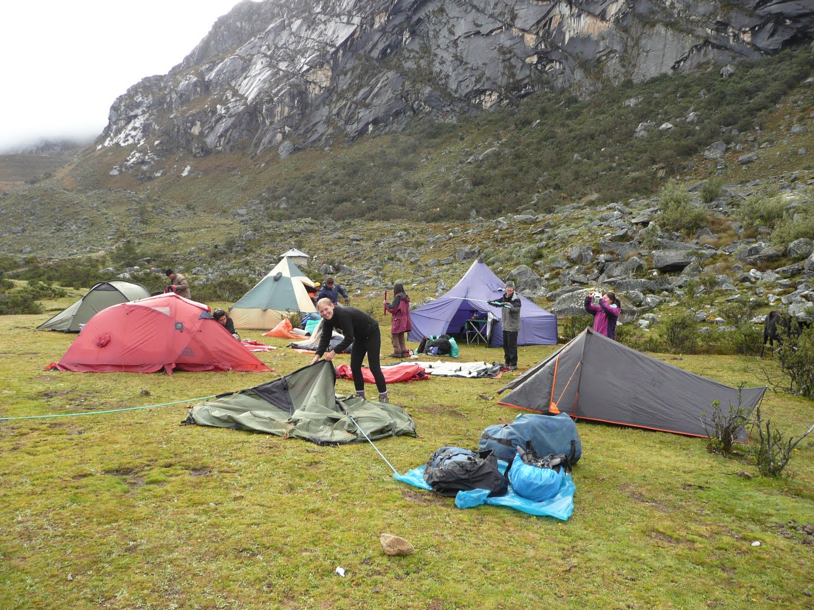
Lunch was in a shed at a small settlement half way up the pass. It was at this point the heavens started to open. Well it is the rainy season after all. To our amazement, the porters (we referred to them as the red army) had raced ahead, each carrying up to 25kg's each, to prepare a 3 course meal. It was top quality and much better than the backpacker food Rach and I have become accustomed to. After another 3 hours or so we reached our camp. The porters had arrived before us and had already put up our tents.  The cook Cecilio was already busy preparing our dinner, another fine feast. How this guy was preparing meals, on a mountain, in the rain, with minimal cooking equipment, was nothing short of voodoo. We went to bed at 8pm ready for a 5.30am start. It rained most of the night but we were warm, dry and dead to the world.

Being overtaken by the Red Army as they rush to set up camp before we arrive. Hats off!


Day 2
The following morning was the toughest part of the trail. A three hour climb up Dead Woman's Pass to the summit of the Abra Huarmihuanusca at 4,200 mtrs above sea level. It rained the whole way up but that did nothing to dampen our spirits. Whilst the views were sporadic and interspersed with cloud and mist, it gave the mountain a mystic feel and, in my view, added to the drama of this ancient trail. The wind at the top was relentless, wet and in just shorts and a T-shirt I was starting to get cold. After re grouping at the top big Canadian Ryan and I pretty much ran down the other side. Well I was running but I think Ryan was at normal pace. The descent was steep and slippy, especially in the rain. Poor Rach slipped and bruised her back but luckily we had plenty of pain killers and our guide had a special ointment. After a couple of offers from the porters I decided it was more appropriate for me to massage the ointment into Rachel’s back. After a few minutes she was back on the mend and ready to conquer the second climb of the day, imaginatively referred to as The Second Pass.

The summit of the Abra Huarmihuanusca at 4,200 mtrs above sea level. 
Cold and wet with genuine fake smiles


The group on the imaginatively named 2nd Pass with Dead Woman's Pass in the background

 
Half way up the second pass we stopped at an Inca ruin known as Runkuracay. Our guide Flavio described in detail how the Inca's used these sites for growing crops using Inca terracing transforming incredibly steep mountain slopes into flat areas for agriculture. Our second night’s camp was in the cloud forest just below the Inca site Sayacmarca to watch the sunset over glaciers and high Andes peaks. Once again, Cecilio cooked us a restaurant standard meal topped off with a cucumber carved into a very convincing Llama shape. Luckily Drew was on hand to bite its head clean off.

View from camp 3 with the Andes in the distance


Day 3
The rain had been kind to us over night so I suppose the heavy downpour 10 minutes after setting off up The Third Pass (pure genius) was expected. Here the trail is completely original as the worn flagstone path weaves it way through the jungle. There were caves carved through solid rock and steps carved into the bedrock from a by gone age. After a 900 metre descent, passing too many different species of orchid to remember, we arrived at the ruin of Puyupatamarca 'The Town above the Clouds' before descending further into the valley to another ruin called Winay Wayna, almost as impressive as Machu Picchu. This place was used by the Inca’s as a type of biological experimental area. The steep slopes of terracing each had their own micro climate and it is thought the Incas experimented with different temperatures and humidity to produce different types of corn at different times of the year. Clever stuff.

Group pose with porters. See if you can spot the cook...


An Orchid. It has a beautiful name of which I cannot remember, not a sniff. Sorry


The ruin of Puyupatamarca 'The Town above the Clouds'
 

View from our tent across the Urubamba Valley


Winay Wayna, an Inca biological experiment


Day 4
We started the day at 3.30am to reach the Sun Gate at Machu Picchu for sunrise.  Our porters literally broke down the camp around us as we rushed breakfast to get to the start of the trail first. Surprisingly, throughout the last few days we didn't feel like there were 500 hundred people of the trail. We didn't really see many people at all until the last campsite. Perhaps because everybody is going in the same direction but also because the guides ensure the groups and campsites are staggered. That all changed when we reached the last checkpoint. Everybody wants to be at the Sun Gate first so we found ourselves in line at the last gate before entering the Machu Picchu citadel. After waiting around for an hour the gate opened at 5.30am an there was a last dash for 1hr to reach Intipunku (the Sun Gate). The view across Machu Picchu was incredible. Jaw dropping in fact. With Huayna Picchu in the background the setting could not be more dramatic. 3 days of trekking in the rain were rewarded by a beautifully clear morning with postcard mist rising up from the valley.

A the Sun Gate, our first view of Machu Picchu after 3 days of walking, mostly in the mist and rain! Thankfully a beautiful clear morning


What you've all been waiting for...
Machu Picchu (Old Mountain) with Huayna Picchu (Young Mountain) in the background


Knackered and ready for a bath...


After fighting for space to take some pictures our guide Flavio gave us a 3 hour tour of the ruins explaining the reasons behind the location, the orientation of the Temple of the Sun aligning with the summer and winter solstice, the sacred rock and the discovery by the American Hiram Bingham in 1911. The amazing thing about Machu Picchu is that it is still pretty much intact. It escaped the destruction of the Spanish conquerors because the Inca's made sure they never found it. It was originally thought to be the last stronghold of the Incas. However, in 1940 doubts were raised and more recently the site of Espiritu Pampa in the jungle is considered to be such site. Either way, Machu Picchu is still considered to be the best preserved Inca citadel in South America. Our photos just don't do it the justice it deserves.


After a short ride down the mountain to the town of Aqua Caliantes we had lunch and a beer with our new friends. Rach and I spent the night here before returning to Cusco the following day to meet up with the group for a farewell lunch. Just like the way we met them we were late once again. Very late. Sorry to Ryan and Cindy who we missed. We had such a fantastic experience, shared with the perfect group.

Huaraz and the Santa Cruz Valley in the Cordillera Blanco next for yet more trekking....